Shoshone, California

Shoshone, California, is a very small desert town located near the southern entrance to Death Valley National Park. It was founded in 1910 by Ralph Jacobus "Bob" Fairbanks, a mining engineer who saw potential in the area as a supply point for miners and travelers. The town was named after the Shoshone people, one of the Native tribes of the Great Basin.
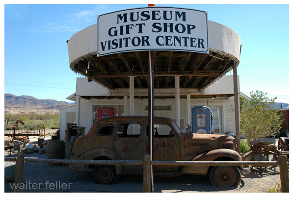
Shoshone became important as a stop along State Route 127 and the Tonopah and Tidewater Railroad. At its peak, it offered services like a gas station, store, post office, and even a school, making it a hub for scattered desert residents. Today, it is known as a gateway to Death Valley, with a population of fewer than 50 people. Visitors often stop for fuel, food, and the small museum that highlights local history, including mining, Native heritage, and the nearby Amargosa River.
Shoshone – Tecopa Timeline
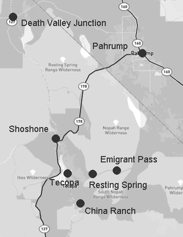
10,000 BCE – 1700s Native peoples, including the Southern Paiute and Western Shoshone, used the Tecopa, Shoshone, Resting Springs, and Amargosa River areas for thousands of years. Springs like Willow Creek and Ibex Springs supported seasonal camps and trade routes connecting the Mojave Desert to the Great Basin.1829–1830 Antonio Armijo led the first successful trade caravan along what became known as the Old Spanish Trail. His route passed near Resting Springs and the future sites of Tecopa and Shoshone, helping establish a commercial corridor between New Mexico and California.
1844–1859 Resting Springs became an important stop on the Mormon Road, used by emigrants and freight teams. Conflicts occurred between Native groups and travelers. Chief Tecopa led local Paiute resistance before later reaching a peace agreement with settlers. In 1859, Lt. Williamson of the U.S. Army surveyed and recorded Resting Springs as a critical water stop.
1875–1880s A mining boom brought the founding of Brownsville, later renamed Tecopa, near Willow Creek. Prospectors also worked claims at Ibex Springs, building stone cabins and hauling ore by mule. Resting Springs was reoccupied briefly as a supply stop. Tecopa declined after richer discoveries nearby.
1900 Quon Sing, also known as Ah Foo, developed China Ranch near Tecopa by irrigating fields along Willow Creek. He grew fruit and raised livestock, leaving a legacy that remains part of the landscape today.
1907 The Tonopah and Tidewater Railroad reached Tecopa and Shoshone. A new townsite, called the Tecopa Triangle, was built closer to the rail line. Mining resumed with easier access to markets.
1910 Shoshone was founded by “Dad” Fairbanks as a rail stop and supply point for nearby mines. It soon had a general store, schoolhouse, and housing for workers.
1920s Mining activity increased at Ibex Springs. Shoshone continued to grow, and Tecopa Hot Springs began to attract visitors as a health retreat. The Shoshone post office was moved from the ghost town of Greenwater.
1930s Women in Shoshone built the Flower Building for community events. Miners lived in hand-dug dwellings at Dublin Gulch. Mining at Ibex Springs continued at a small scale.
1957 Major mining operations in Tecopa ended. The town shifted toward tourism and retirement. Shoshone remained a traveler’s stop on the way to Death Valley.
1960s–1970s Under the Small Tracts Act, new homes were built in Tecopa Heights. Ibex Springs was abandoned. Conservation efforts began to grow for the Kingston Range and Amargosa Basin.
1976 The area was included in the California Desert Conservation Area, giving it federal protection. Resting Springs was identified as a riparian habitat and cultural site.
1994 Death Valley became a National Park. Shoshone’s role as a gateway town increased. The Kingston Range and Nopah Range were designated as wilderness areas, preserving places like Ibex Springs.
2000s–present The Amargosa Conservancy acquired and protected lands around Tecopa, China Ranch, and the river. Shoshone established a museum and promotes its heritage. Tecopa hosts annual events such as the Tecopa Takeover and Firehouse Fling. A public water kiosk was installed in Tecopa Heights. Ibex Springs remains accessible by high-clearance vehicle, with stone ruins and old mining structures still visible.
Shoshone Weather
