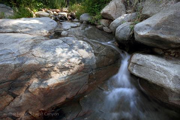
Sawpit Canyon
< Previous <> Next >
Sawpit Canyon, like its neighboring creeks in the western San Bernardino Mountains, has a story tied to both the land and the people who settled Summit Valley.
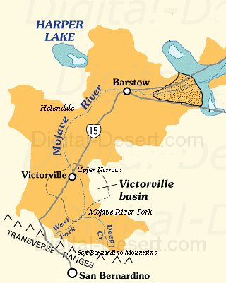
Its history is tied to the ancestral Mojave River system, where every tributary mattered. Snow and rainfall gathered in the higher peaks above todays Crestline and Rimforest areas. As the water moved downslope, it carved narrow canyonsSawpit among themthat funneled runoff toward Summit Valley. By the 1850s, surveyors and early settlers noted Sawpit as one of the feeders of the West Fork of the Mojave River. In a dry land, these modest creeks were lifelines.
The name itself offers a clue to early use. A sawpit was a hand-dug trench where logs could be cut with long saws before mills were common. The San Bernardino Mountains were a source of timber as settlement expanded, and it is likely the canyon was named for such activity. Ranchers and settlers in Summit Valley depended on both timber and water from these side canyons. Families who established themselves therelike Aaron Lane and others who came through after himsaw the tributaries not just as drainage but as sources of stock water, irrigation, and raw materials for homesteads.
By the late 19th century, Sawpit Canyon, Miller Creek, and Cleghorn Canyon all formed a network of seasonal streams flowing toward the confluence at Summit Valley. Together, they fed the Mojave River, whose path across the desert shaped trails, ranching, and eventually railroads. Even when flows were intermittent, the canyons marked routes where water could be found, game could gather, and settlement could take root nearby.
Today, Sawpit Canyon remains a rugged and relatively quiet fold in the mountains. Its steep walls and seasonal flow still tell the same storyhow water, scarce and fleeting in the Mojave country, carved paths that influenced both nature and history.