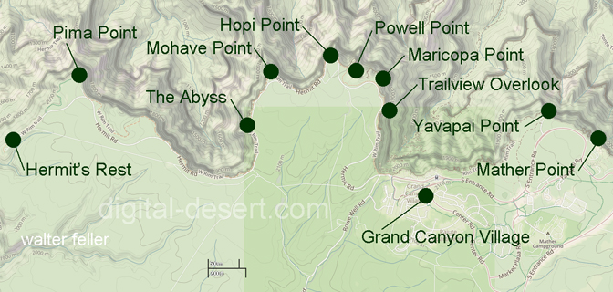
Trailview Overlook
 -
- 
 -
- 
 -
- 
The overlook sits approximately 1.3 miles west of Grand Canyon Village and is generally accessed by the Hermits Rest shuttle route, commonly called the Red Route. During most of the year private vehicles are restricted along Hermit Road, making the shuttle the principal means of access for visitors. A short paved path leads from the shuttle stop to the rim.
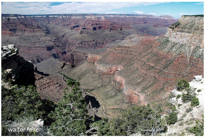
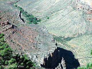
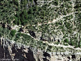
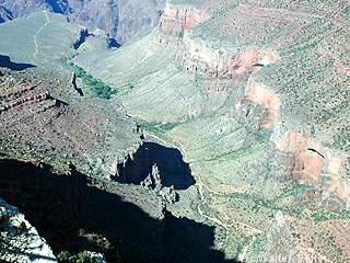
From the overlook, visitors can clearly see the Bright Angel Trail zigzagging through the upper cliff bands below. The trail drops rapidly from the Kaibab Limestone at the rim into older rock layers exposed deeper within the canyon. Stone retaining walls, blasted ledges, and carefully engineered turns remain visible from above, illustrating the extensive labor involved in constructing and maintaining one of the canyon's principal trails. In clear light, portions of Havasupai Gardens far below may also be distinguished among the darker inner canyon formations.
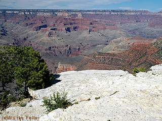
Trailview Overlook is often regarded as one of the best locations on the South Rim for understanding the physical scale of canyon travel. From many overlooks the canyon appears abstract and distant, but Trailview presents it as a navigable landscape marked by visible routes and human movement. The view demonstrates how quickly the terrain falls away from the rim and how small hikers become against the immense geological walls surrounding them.
Lighting conditions strongly affect the appearance of the overlook. Morning light tends to illuminate the trail and inner canyon more evenly, making it favorable for photography. Late afternoon light casts warm illumination across western canyon walls and deepens the relief of the formations below. In winter, snow frequently outlines the switchbacks and retaining walls, creating especially dramatic contrast against the darker stone.
Historically, the overlook developed alongside the rise of organized South Rim tourism in the late nineteenth and early twentieth centuries. As rail travel brought increasing numbers of visitors to the canyon, the Bright Angel Trail became one of the primary descent routes used by tourists, guides, mule trains, and concession operators. Although later engineered and commercialized, portions of the route followed older Indigenous travel corridors long used within the canyon region.
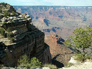
Trailview Overlook is situated among several major viewpoints along Hermit Road, including nearby Maricopa Point, Hopi Point, Mohave Point, and The Abyss. Among them, Trailview remains distinctive for emphasizing descent, scale, and the visible relationship between the canyon rim and the trails below.